Showing posts with label West Fork. Show all posts

Thursday, June 16, 2011

West Fork Wildflower Ride...

We three, took a ride along the West Fork today. I couldn't convince my son to ride the mtb (quite the dedicated roadie) so we were limited to riding the paved section which, if you overlook the climb up Cogswell Dam, did make for a nice relaxing ride. While that was fine, it unfortunately meant I wouldn't be able to follow in the tire treads of White Boy Be Crazy, who earlier in the year continued along the dirt on the far side of the dam. This approx. 14 mile route is one of the easiest mountain rides you will find in the San Gabriel Mountains, and a great place to spend an afternoon; maybe this year I can get it together and organize a little ride up there. The West Fork is a popular catch and release spot for fisherfolk, and a couple guys had figured out that by bringing their bikes they could reach the areas further back, away from the easier, walking distance stretches of river.

a couple of the numerous small cascades dropping into the canyon 
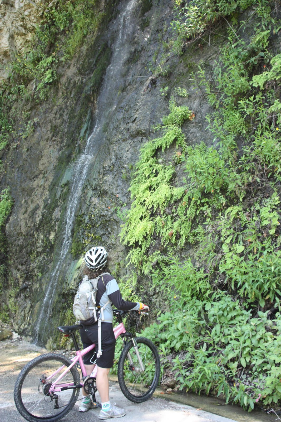

and another more vertically inclined one. you could easily get under this one and catch the spray. the sun was just peeking over the drop way up above and making little prisms out of the spray, and i thought it would make a nice photo, a bunch of little sparkles dropping from the sky, but apparently not.
maybe i need a special filter for that


columbine


the river road through one of the narrow sections of canyon

monkeyflower


leopard lily, i'm thinking


yet another of the small waterfalls


admittedly, that climb to the top of Cogswell Dam is quite steep,
so i didn't give them too much grief for walking much of it. Mt. Baldy in the distance

first snake of the day, just a plain old...i actually don't know what kind


does a plethora of flowers this time of year equate to a plethora of berries later?
if so, there will be a feast this autumn

snake no. 2, a pudgy little rattler

one final view of the West Fork San Gabriel River

By the way, does anyone know about access across Cogswell Dam, I know there is a gate at the houses (which I have never seen closed) and no one has ever said anything to me; I have never been warned away, nor heard of anyone being told to stay out. There were a bunch of Public Works people up there today, and again, not a word to my son or me as we rode through, but when my wife came up behind they asked what she was doing in a restricted access area. She continued on, regardless, to get up to us across the dam. What gives? The land all around is National Forest, so can the County deny access across the dam which, from what I can tell is owned by the County Flood Control District, and managed by Public Works?

Friday, September 10, 2010

My Favorite Routes III: Highway 39, Part 1...

I guess I first discovered this ride some 15 years ago while living in Pasadena; Highway 39, San Gabriel Canyon was just one of those San Gabriel Mountain rides that anyone who considered themselves to be a climber had in their repertoire of rides. As far as these mountain road rides go, I had moved progressively east over the years starting with the Big and Little T's (Big Tujunga and Little Tujunga Canyons), and Angeles Crest and Angeles Forest Highways, while living in Burbank. Then came Big Santa Anita Canyon to Chantry Flats. Next in order should have been San Gabriel Canyon (aka Azusa Canyon), but I momentarily skipped it to conquer Glendora Mountain Road (GMR) and Glendora Ridge Road (GRR) due to a race along these two. But the Highway 39 climb was always talked of in almost epic terms, as if you were not someone until you made the trek to Crystal Lake. During the mid-1990s this became a regular training ride of the team is was riding with, as well as when out by myself.


So where to begin? How about Duarte, it is as good a place as any, maybe better since the first two miles of this route takes you up the San Gabriel River Trail to its end at the mouth of the canyon. Actually since they extended the path a number of years ago you can stay on it for a bit further, or exit at the visitor center and take to the road from there. I split this ride into two parts mostly because the first half is so different from the second. The grades down in the lower portion of the canyon are more slight, and the gradual upward trend is broken by occasional short sections of descending. Anyway, take your eyes off the road ahead from time to time and you will notice the river rolling along off and down below to the right. It actually looked and sounded like there were a series of rapids along portions today, I suppose because they had the floodgates open below the lower dam, so there was a lot more water than normal rushing down river.
last bit of SGRT

San Gabriel River, framed

turning up

Morris Dam

was it not cool of the bridge designers to provide these little windows to frame the view

Morris Reservoir

how cute, they cut the mountain to match the dam

Mt. Baldy

East Fork Bridge

It isn't long before you crest out (momentarily) at said first dam, the Morris Dam. If you are new to the canyon, congratulate yourself on reaching this first landmark. With the blue waters of the reservoir down below to your right you descend for a bit, but then start climbing again. Signs along the road warn you not to trespass or loiter, so keep the wheels spinning. Not too far beyond Morris Dam you may notice the concrete ramp perched above the water edge; this is a little of what remains of an old naval weapons testing base which began operations in World War II. Submarine-based weapons systems were developed here, things like torpedoes, and even the Polaris rocket. The base was decommissioned I believe in the 1990s. From here you enjoy a little more descending, before another climb, this time to peak above the second dam, San Gabriel Dam. Unlike Morris Dam, which is concrete, San Gabriel Dam is an earthen dam. Again you will ride along with the reservoir down below to the right until one final short descent brings you to the East Fork. If at the bridge you take a right and cross over you can eventually hook up to the GMR mentioned earlier and make a loop. But we will stay the course along Highway 39 which is mostly level for a bit now. Pass the OHV area and the Rincon Fire Station, tackle a short hill, and arrive at the West Fork. This is a popular fishing area and staging area for mtb trips along local trails.


the various fishing platforms along the West Fork are named for the fish that can be found there

wet pavement

deeper into the mountains

Glenn Camp

color coordination

the river road

all's well that ends well


Since I arrived here having hardly broken a sweat, I decided I would ride along the West Fork for the seven miles it takes to get to Glenn Camp. This is a paved road, closed to traffic (though there may be occasional Forest Service or utility vehicles) so don't completely let your thoughts wander to the surroundings, as compelling as that may be. The 14 mile round trip West Fork is as easy a paved ride in the mountains as you will find. Watch for an upcoming "Bring Out Your Bikes" series ride taking place here, to be posted soon. Glenn Camp near roads end was my turn around point, and getting back was just a matter of shooting back down canyon. The wind today, did not seem to want me to leave, and kept trying to push me back up canyon. I won out though, hard not to when heading downhill. Friday traffic was light, especially returning; expect weekend traffic to be heavier, but still not bad considering how many people live in the city down below. By the way traffic tapers off dramatically beyond the West Fork, for whatever reason you may only be passed by a handful of vehicles on some days. Total distance for this first half of the Highway 39 ride was 38.3 miles, I rode it in 2.5 hours, though that included many stops for photos and the cruising speed West Fork section. Part two will cover the section between West Fork and Crystal Lake, the much steeper, more epic portion. One additional note on the road - like most mountain roads this one is not for the timid, there are sections where the pavement crumbles away into the dirt right at the white painted lane line, and you will be riding in the lane. The rewards are well worth the effort, but if you are at all apprehensive about riding in close proximity to motor vehicles, this may not be the ride for you.


My Favorite Routes II: Mountain Junction Loop
My Favorite Routes I: the Palmer-Evey
Related Posts Plugin for WordPress, Blogger...